720: DEUTSCHLAND – BLAEU, J.,
regular tax scheme 7% VAT
Ergebnis: 2.400,- €

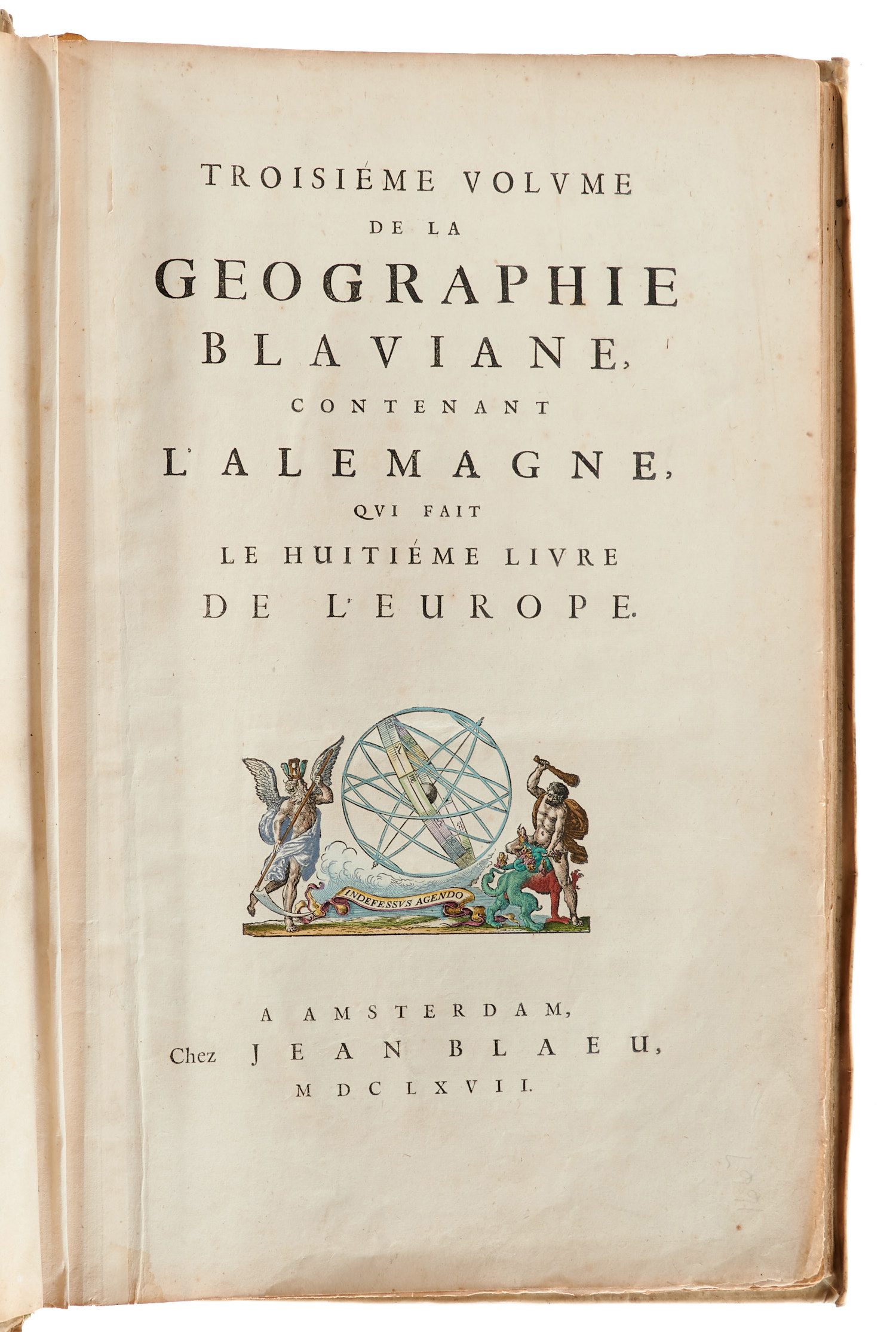

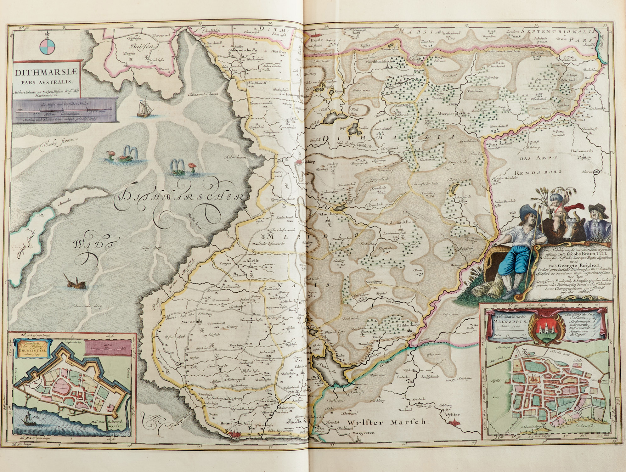
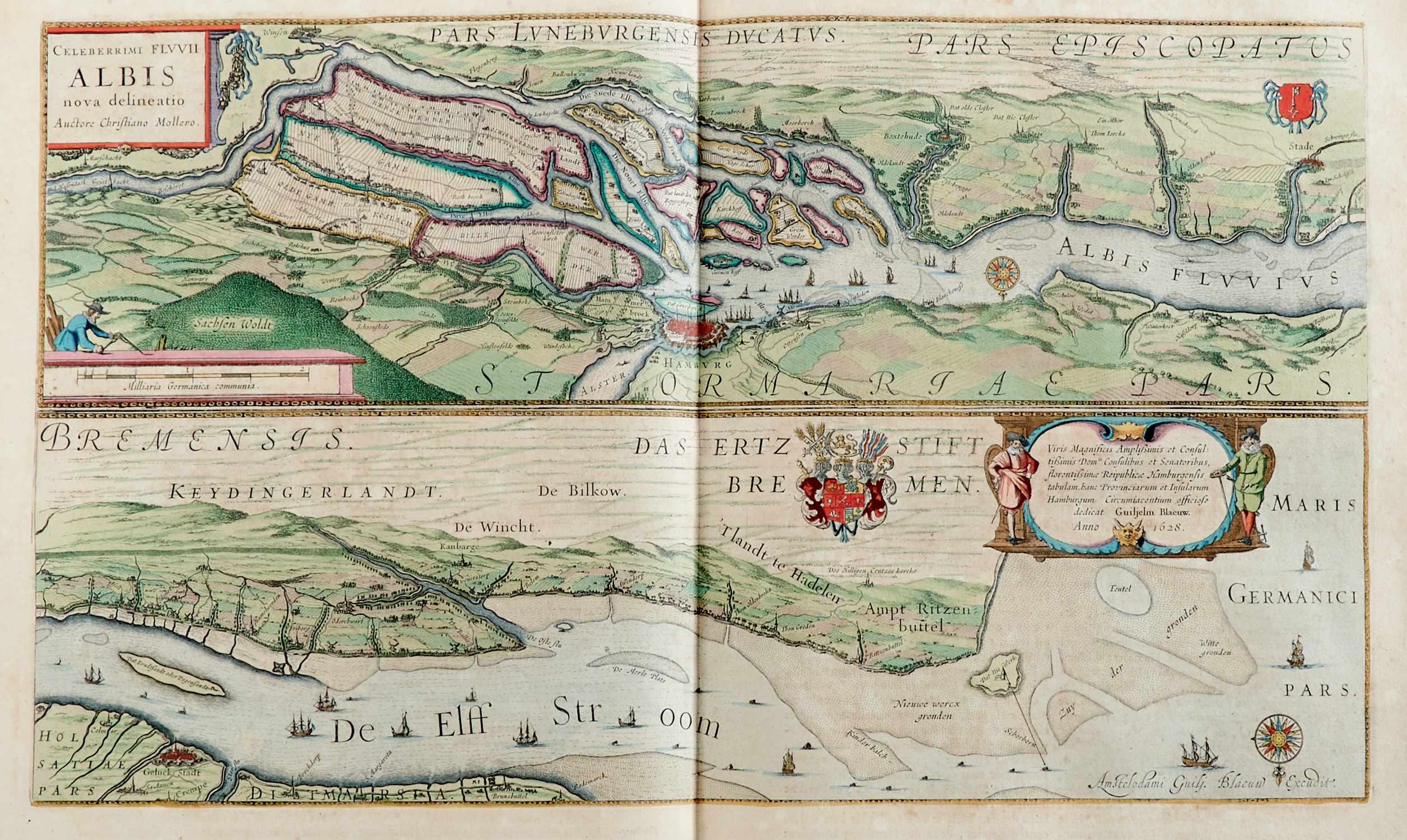
Van der Krogt 2:611.3. – Enthalten sind unter anderem die Karten von Deutschland, Mähren, Schlesien, Grafschaft Glatz, Steiermark, Vogtland, Meißen, Anhalt, Brandenburg, Ruppin, Mecklenburg, Elbe, Bremer Förde, Magdeburg, Halberstadt, Hildesheim, Westfalen, Oldenburg, Hessen und Oberschwaben. – Die schönen altkolorierten Karten mit figürlichen Kartuschen, Vignetten, Wappen, Schiffsdarstellungen usw. – Die Donau-Karte als Fragment enthalten; einige Karten am Bug mit Einriß bis ins Bildfeld, tls. im weißen Rand unten etw. wasserrandig, einige Quetschfalten, etw. fleckig, leicht gebräunt.
Fragment of the 3rd volume of the atlas by J. Blaeu. – With 38 (37 double-sheet-sized) engraved maps with coloured borders. – Contains the maps: Germany, Moravia, Silesia, County of Kladsko, Styria, Vogtland, Meissen, Anhalt, Brandenburg, Ruppin, Mecklenburg, the Elbe river, Bremervoerde, Magdeburg, Halberstadt, Hildesheim, Westphalia, Oldenburg, Hesse and Upper Swabia. – Containing a fragment of the map of the Danube; some maps with tear at inner margin up to the image, bottom white margin partially somewhat waterstained, some creases, somewhat soiled, slightly tanned. – Contemporary vellum with gilt-tooling, monogramed "O. F. V. S." (scuffed, slightly bumped and somewhat soiled).