716: SAMMELATLAS
Ergebnis: 3.000,- €
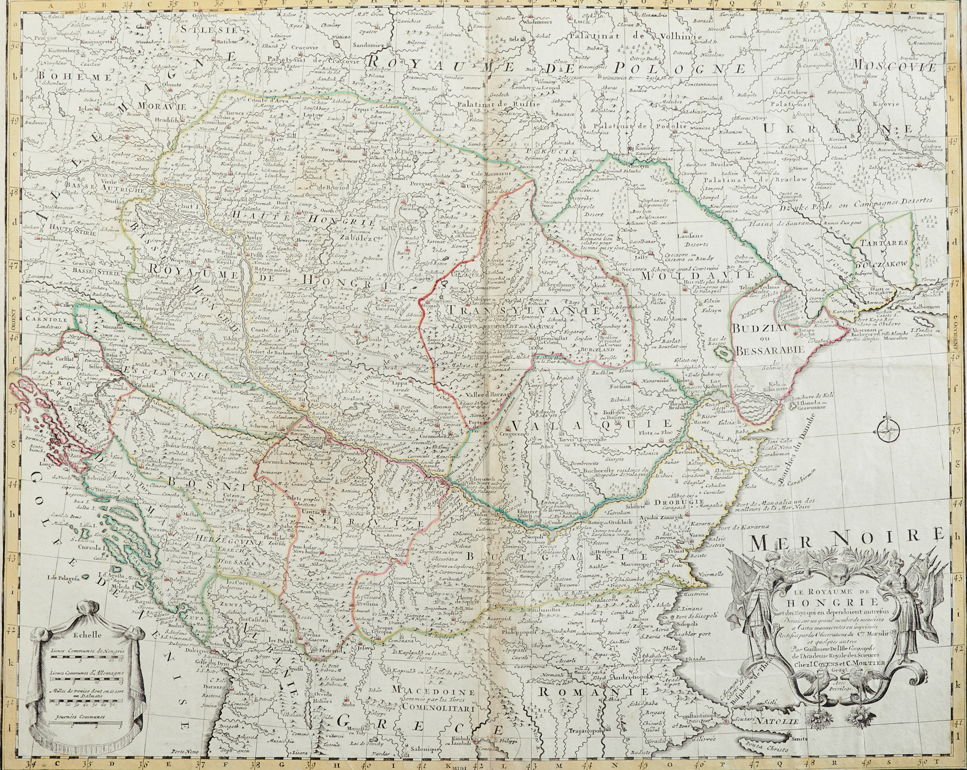
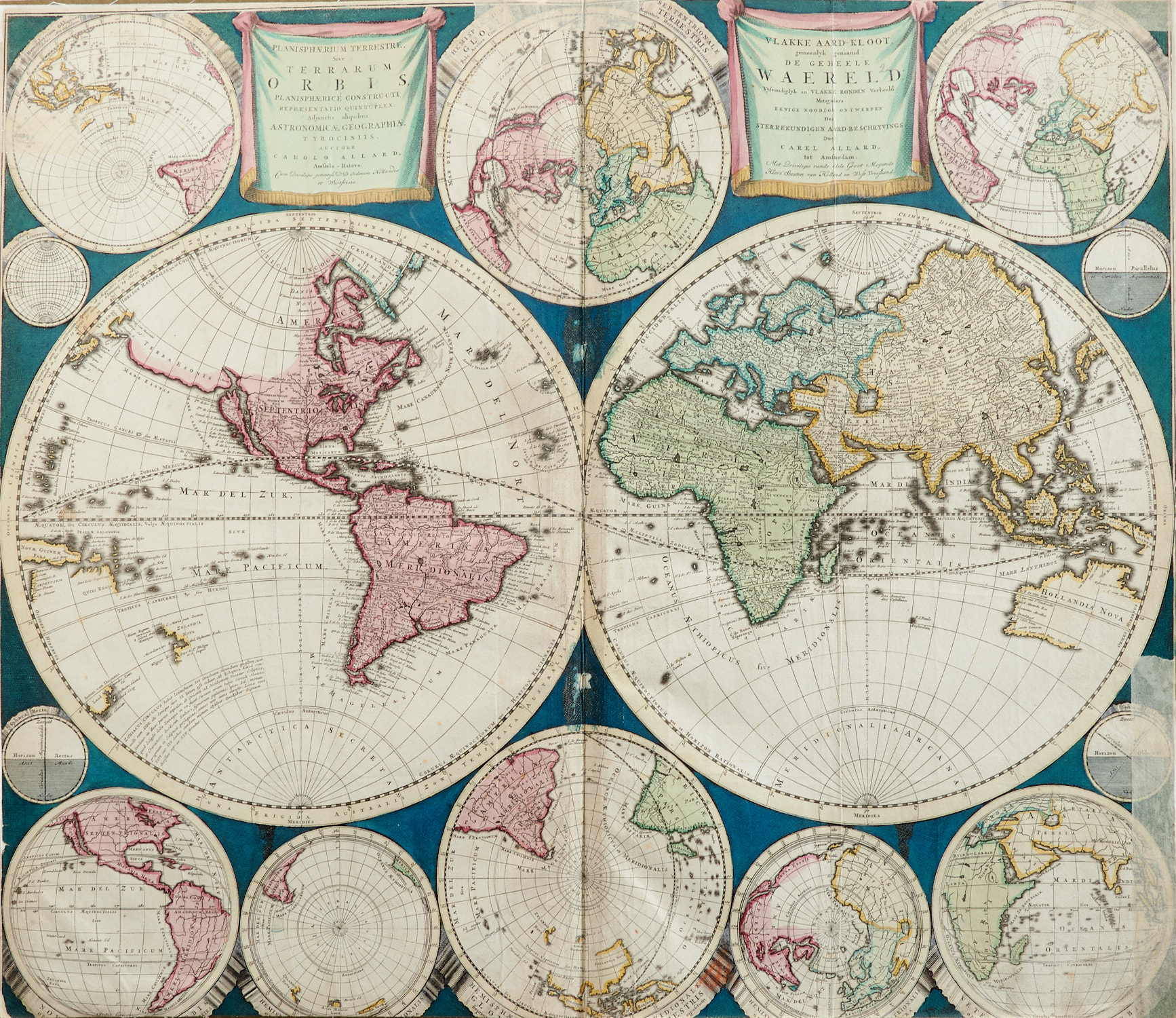
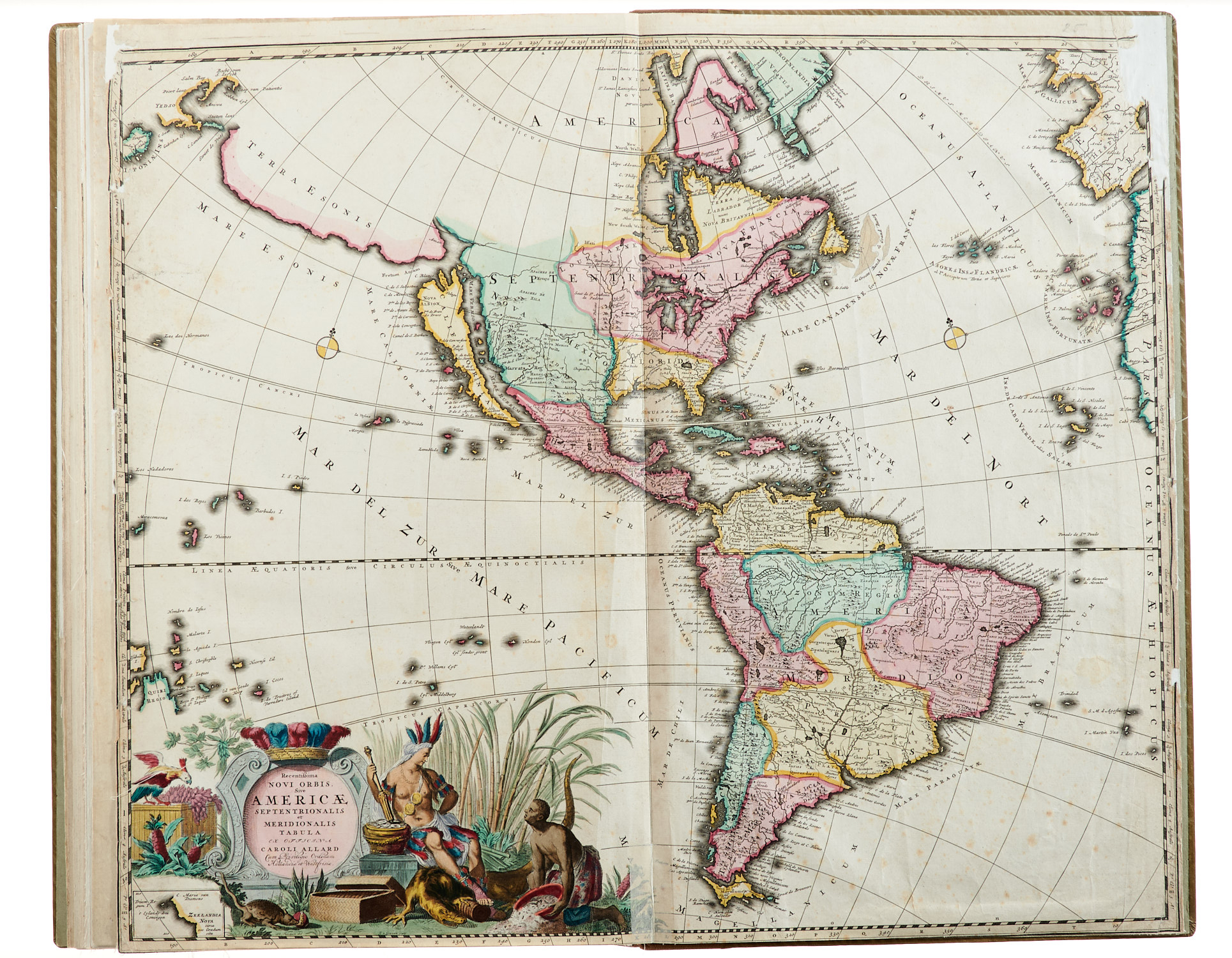
Enthalten unter anderem von Carel Allard: Weltkarte, Europa, Asien, Afrika und Amerika; von Covens und Mortier: Ungarn (mit winzigem Löchlein in der Kartusche und leichten Faltspuren); von Danckerts: Rußland, Baltikum (mit leichter Quetschfalte) und Ostpreußen; von Visscher: Osmanisches Reich. – Alle Karten am Bug mit Lwd. verstärkt, Titel aufgezogen und am Rand mit Lwd. hinterlegt; die Karten (außer Ungarn und Baltikum) knapp oder bis zum Bildrand beschnitten sowie mit laienhaft hinterlegten Fehlstellen am Rand, vereinzelt auch im Bug, etw. fleckig.
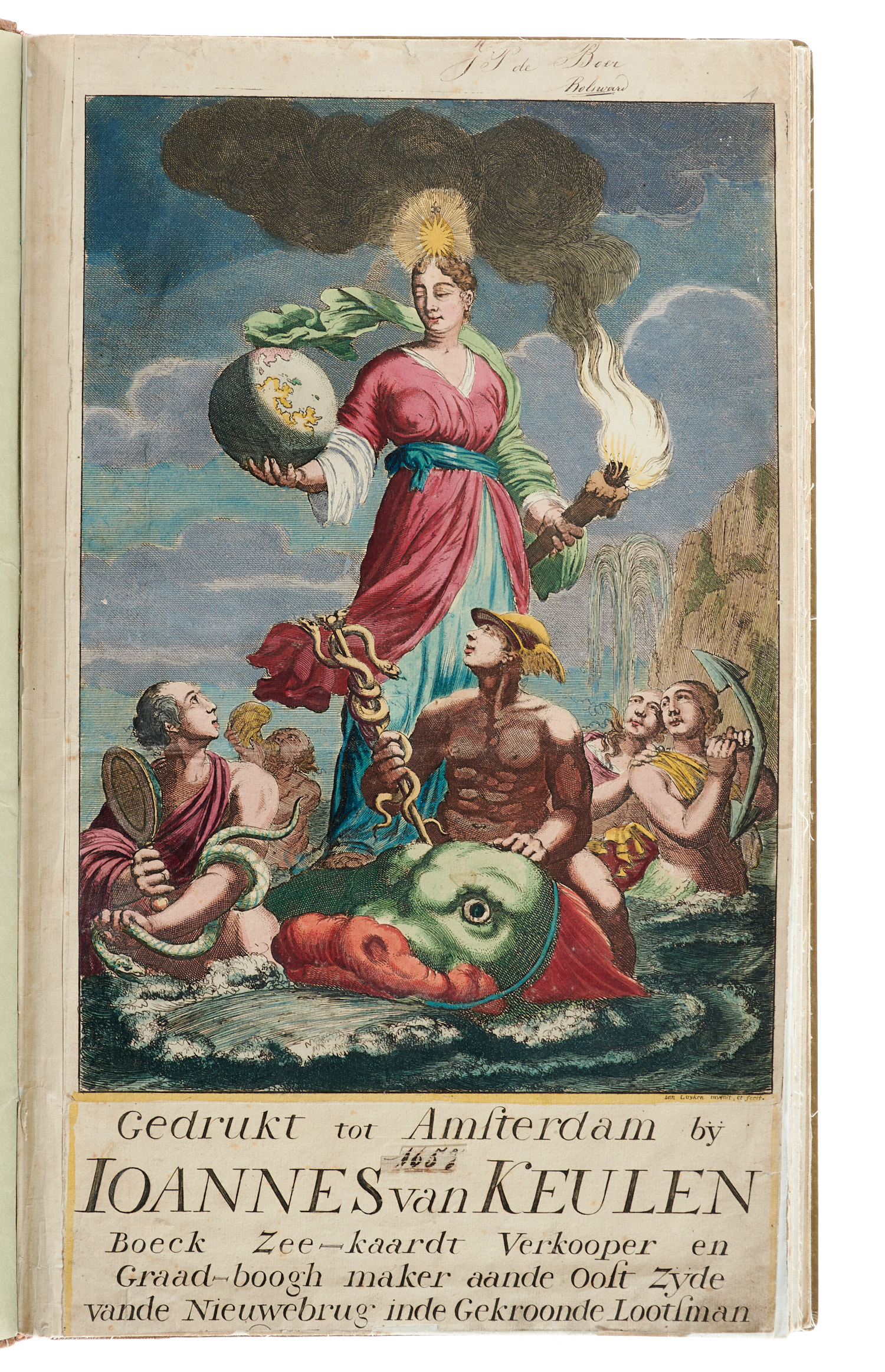
Collective volume with 24 double-page-sized, copper-engraved maps (23 in old colouring, 1 with outlines in old colouring) and 1 title page from a Van Keulen atlas in old colouring. By Allard (6), Covens and Mortier (1), Danckerts (11), Visscher (3) and De Wit (3). – Amongst those maps are: world map, Europe, Asia, Africa and America by Carel Allard; Hungary by Covens and Mortier (with a tiny hole and slight creases); Russia, Baltic States (with crease) and East Prussia by Danckerts; Ottoman Empire by Visscher. – The maps linen-backed at the joint, title mounted and with linen-backed margins, trimmed (with the exception of Hungary and the Baltic States), with non-professional restorations on the margins and sporadically at the inner joint, somewhat soiled. – Modern half calf.